
Bühler topographic map
Interactive map
Click on the map to display elevation.
About this map
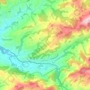
Name: Bühler topographic map, elevation, terrain.
Location: Bühler, Mittelland, Appenzell Ausserrhoden, 9055, Schweiz (47.36800 9.40032 47.39326 9.45434)
Average elevation: 930 m
Minimum elevation: 784 m
Maximum elevation: 1,132 m
Other topographic maps
Click on a map to view its topography, its elevation and its terrain.
Bach
Schweiz > Appenzell Ausserrhoden > Mittelland > Trogen
Bach, Trogen, Mittelland, Appenzell Ausserrhoden, 9043, Schweiz
Average elevation: 950 m