
Budondo topographic map
Interactive map
Click on the map to display elevation.
About this map
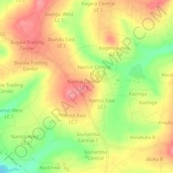
Name: Budondo topographic map, elevation, terrain.
Location: Budondo, Jinja City, Eastern Region, Uganda (0.49556 33.14500 0.53556 33.18500)
Average elevation: 1,158 m
Minimum elevation: 1,101 m
Maximum elevation: 1,200 m
Other topographic maps
Click on a map to view its topography, its elevation and its terrain.