
苍岭镇 topographic map
Interactive map
Click on the map to display elevation.
About this map
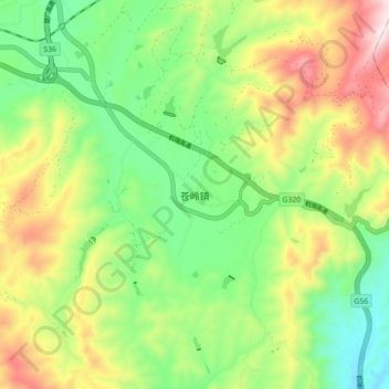
Name: 苍岭镇 topographic map, elevation, terrain.
Location: 苍岭镇, 楚雄市, 楚雄彝族自治州, 云南省, 中国 (25.00980 101.63600 25.08980 101.71600)
Average elevation: 1,884 m
Minimum elevation: 1,649 m
Maximum elevation: 2,248 m
Other topographic maps
Click on a map to view its topography, its elevation and its terrain.