Geolocate

Laitsoke topographic map

Interactive map

Click on the map to display elevation.

About this map

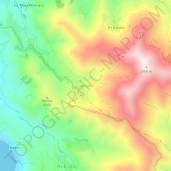
Name: Laitsoke topographic map, elevation, terrain.

Location: Laitsoke, Leribe District, Lesotho (-29.22532 28.49794 -29.18532 28.53794)

Average elevation: 2,435 m

Minimum elevation: 2,052 m

Maximum elevation: 2,874 m

Other topographic maps

Click on a map to view its topography, its elevation and its terrain.

Botso Water Reseviour

Lesotho > Leribe District

Botso Water Reseviour, Leribe District, Lesotho

Average elevation: 2,285 m

Hlotse

Lesotho > Leribe District

Hlotse, Leribe District, 300, Lesotho

Average elevation: 1,628 m

Mohope

Lesotho > Leribe District > Mohope

Mohope, Leribe District, Lesotho

Average elevation: 1,664 m

Hlotse

Lesotho > Leribe District

Hlotse, Leribe District, Lesotho

Average elevation: 1,711 m