
Botso Water Reseviour topographic map
Interactive map
Click on the map to display elevation.
About this map
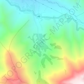
Name: Botso Water Reseviour topographic map, elevation, terrain.
Location: Botso Water Reseviour, Leribe District, Lesotho (-29.05894 28.33227 -29.05841 28.33275)
Average elevation: 2,285 m
Minimum elevation: 1,928 m
Maximum elevation: 2,990 m
Other topographic maps
Click on a map to view its topography, its elevation and its terrain.