

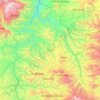
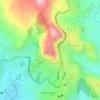
Kamisee topographic map
Click on the map to display elevation.
Kamisee
Kemise (Oromo: Kamisee; Amharic: ከሚሴ) is a town and administrative seat of the Oromia Zone in the Amhara Region, Ethiopia. Kemise is 224 kilometres (139 mi) northeast of the Ethiopian capital, Addis Ababa and has a latitude and longitude of 10°43′N 39°52′E / 10.717°N 39.867°E / 10.717; 39.867 with an elevation of 1424 meters above sea level. It was part of the former Chaffa Gola Dewerahmedo district and is now surrounded by the Dawa Chaffa district.
About this map

Name: Kamisee topographic map, elevation, terrain.
Location: Kamisee, Oromia, Amhara Region, Ethiopia (10.67644 39.82703 10.75644 39.90703)
Average elevation: 1,494 m
Minimum elevation: 1,409 m
Maximum elevation: 1,945 m
Other topographic maps
Click on a map to view its topography, its elevation and its terrain.
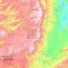
Germama/kesem
The Germama is not a navigable stream, and flows with a great volume during the rainy season. It rises west of Kese Koremash, flowing east to the Awash, its course delineating a few kilometers of the northern boundary of the Awash National Park. The Kessem River passes an altitude drop from more than 2000 m on…
Average elevation: 1,306 m