
Beit Lahiya topographic map
Interactive map
Click on the map to display elevation.
About this map
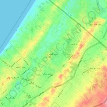
Name: Beit Lahiya topographic map, elevation, terrain.
Location: Beit Lahiya, 500, Palestinian Territories (31.50977 34.46247 31.58977 34.54247)
Average elevation: 37 m
Minimum elevation: 0 m
Maximum elevation: 98 m
Other topographic maps
Click on a map to view its topography, its elevation and its terrain.
Wadi al Qilt
Palestinian Territories > Judea and Samaria > Area C > Ma'ale Adumim > Wadi al Qilt
Average elevation: 96 m