
Nabih Saleh topographic map
Interactive map
Click on the map to display elevation.
About this map
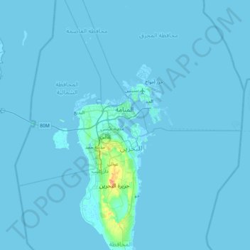
Name: Nabih Saleh topographic map, elevation, terrain.
Location: Nabih Saleh, Manama, Capital Governorate, 604, Bahrain (25.86238 50.26430 26.50238 50.90430)
Average elevation: 2 m
Minimum elevation: -3 m
Maximum elevation: 123 m
Other topographic maps
Click on a map to view its topography, its elevation and its terrain.