
Ilsandong-gu topographic map
Interactive map
Click on the map to display elevation.
About this map
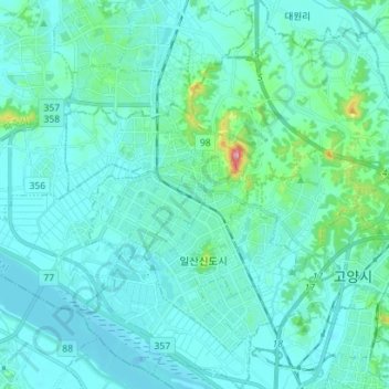
Name: Ilsandong-gu topographic map, elevation, terrain.
Location: Ilsandong-gu, Goyang-si, Gyeonggi, South Korea (37.62564 126.73248 37.73703 126.85609)
Average elevation: 23 m
Minimum elevation: -16 m
Maximum elevation: 207 m
Other topographic maps
Click on a map to view its topography, its elevation and its terrain.