Geolocate

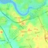
Lytham topographic map

Click on the map to display elevation.

About this map

Name: Lytham topographic map, elevation, terrain.

Location: Lytham, Borough of Fylde, Lancashire, England, FY8 5PB, United Kingdom (53.69882 -3.00516 53.77882 -2.92516)

Average elevation: 6 m

Minimum elevation: 0 m

Maximum elevation: 39 m

Lancashire trails, hiking, mountain biking, running and outdoor activities

Other topographic maps

Click on a map to view its topography, its elevation and its terrain.

Kirkham

United Kingdom > England > Lancashire > Borough of Fylde > Wesham

Average elevation: 22 m

Gear up for your next adventure:

🧦Merino Wool Hiking Socks - Moisture-wicking socks to prevent blisters during long mountain walks
📷Camera Straps - Secure straps for carrying cameras while walking
🧣Neck Gaiters - Protects against wind and sun on exposed ridges and peaks
🛰️Outdoor GPS Navigation - Navigation devices for remote and off-grid areas
🧣Fleece Neck Warmers - Extra insulation for winter topographic surveys

As an Amazon Associate, this site earns from qualifying purchases at no extra cost to you.