Geolocate

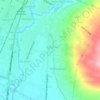
Tlogowaru topographic map

Click on the map to display elevation.

About this map

Name: Tlogowaru topographic map, elevation, terrain.

Location: Tlogowaru, Malang, Kedungkandang, East Java, Indonesia (-8.05157 112.64246 -8.02454 112.67683)

Average elevation: 448 m

Minimum elevation: 388 m

Maximum elevation: 629 m

Other topographic maps

Click on a map to view its topography, its elevation and its terrain.

Tarekot Malang City Park

Indonesia > East Java > Malang

Average elevation: 445 m

Kedungkandang

Indonesia > East Java > Malang

Average elevation: 453 m

Gear up for your next adventure:

💧Hydration Reservoirs - Convenient water bladders for hands-free drinking on the move
🧥Softshell Jackets - Breathable jackets for active outdoor use
🧥Breathable Waterproof Jackets - Essential rain protection for the unpredictable British climate
🎒Hiking Daypacks (20L) - Compact backpacks for day trips and technical mountain ascents
🦟Anti-Midge & Tick Repellent - Vital for hiking in the Scottish Highlands during summer

As an Amazon Associate, this site earns from qualifying purchases at no extra cost to you.