
Make a donation
Gear up for your next adventure:
As an Amazon Associate, this site earns from qualifying purchases at no extra cost to you.
West Linton topographic map
Click on the map to display elevation.
Make a donation
Gear up for your next adventure:
As an Amazon Associate, this site earns from qualifying purchases at no extra cost to you.
About this map
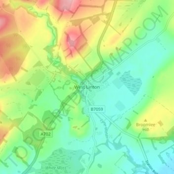
Name: West Linton topographic map, elevation, terrain.
Average elevation: 264 m
Minimum elevation: 213 m
Maximum elevation: 355 m
Scottish Borders trails, hiking, mountain biking, running and outdoor activities
Make a donation
Gear up for your next adventure:
As an Amazon Associate, this site earns from qualifying purchases at no extra cost to you.
Other topographic maps
Click on a map to view its topography, its elevation and its terrain.
Make a donation
Gear up for your next adventure:
As an Amazon Associate, this site earns from qualifying purchases at no extra cost to you.
Greenknowe Tower
United Kingdom > Scotland > Scottish Borders > Gordon > Nether Huntlywood
Average elevation: 157 m
Make a donation
Gear up for your next adventure:
As an Amazon Associate, this site earns from qualifying purchases at no extra cost to you.
Make a donation
Gear up for your next adventure:
As an Amazon Associate, this site earns from qualifying purchases at no extra cost to you.
Moffat Hills
United Kingdom > Scotland > Scottish Borders > Tweedsmuir
The Megget Stane (OS. Ref. NT152203) is by a cattle grid at the highest point between the Talla and Megget reservoirs on the minor road which runs from Tweedsmuir on the A701 to Cappercleuch by shore of St Mary's Loch. It is quite easy to miss the stone when coming from Talla as it is hidden by a gate. At an…
Average elevation: 430 m
Curling Pond
United Kingdom > Scotland > Scottish Borders > Earlston > Georgefield
Average elevation: 153 m
Make a donation
Gear up for your next adventure:
As an Amazon Associate, this site earns from qualifying purchases at no extra cost to you.
Hirsel Lake
United Kingdom > Scotland > Scottish Borders > Coldstream > The Hirsel
Average elevation: 37 m