Geolocate

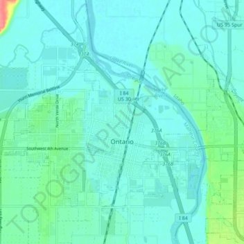
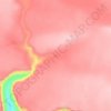
Ontario topographic map

Click on the map to display elevation.

Ontario

Ontario is in northeastern Malheur County, bordered to the east by the Snake River, which forms the state line with Idaho. The city is located at an elevation of 2,150 feet (660 m) above sea level. Via Interstate 84 it is 30 miles (48 km) northwest of Caldwell, Idaho, and 56 miles (90 km) northwest of Boise, as well as 73 miles (117 km) southeast of Baker City, Oregon.

Wikipedia (CC-BY-SA 3.0)

About this map

Name: Ontario topographic map, elevation, terrain.

Location: Ontario, Malheur County, Oregon, 97914, United States (44.01022 -117.01989 44.05253 -116.93534)

Average elevation: 660 m

Minimum elevation: 649 m

Maximum elevation: 714 m

Other topographic maps

Click on a map to view its topography, its elevation and its terrain.
Nyssa

United States > Oregon > Malheur County

Average elevation: 667 m

Half Way Tree

United States > Oregon > Malheur County

Average elevation: 1,498 m

Upset

United States > Oregon > Malheur County

Average elevation: 1,128 m

Basque

United States > Oregon > Malheur County

Average elevation: 1,411 m

Gear up for your next adventure:

👟Women's Trail Running Shoes - Agile footwear for fell running and technical trails
🧊Personal Water Filters - Drink safely from mountain streams marked on your map
🛰️Handheld GPS Devices - Reliable GPS units for hiking and outdoor navigation
🎒Replacement Sternum Straps - Repair parts for hiking rucksacks
⌚Altimeter Watches - Watches measuring altitude for mountain activities

As an Amazon Associate, this site earns from qualifying purchases at no extra cost to you.