
النزهة topographic map
Interactive map
Click on the map to display elevation.
About this map
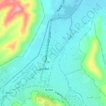
Name: النزهة topographic map, elevation, terrain.
Location: النزهة, معتمدية تطاوين الشمالية, Tataouine, Tunisia (32.92619 10.44956 32.94460 10.45910)
Average elevation: 263 m
Minimum elevation: 218 m
Maximum elevation: 423 m
Other topographic maps
Click on a map to view its topography, its elevation and its terrain.