
Hachimantai topographic map
Interactive map
Click on the map to display elevation.
About this map
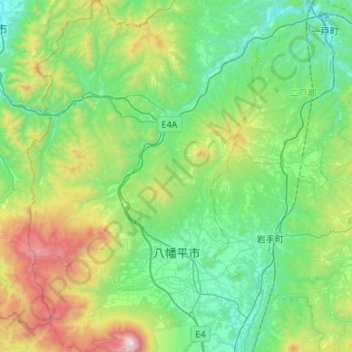
Name: Hachimantai topographic map, elevation, terrain.
Location: Hachimantai, Iwate Prefecture, Tohoku, Japan (39.83993 140.84436 40.24764 141.16908)
Average elevation: 549 m
Minimum elevation: 117 m
Maximum elevation: 2,022 m
Other topographic maps
Click on a map to view its topography, its elevation and its terrain.