
Kanwa topographic map
Interactive map
Click on the map to display elevation.
About this map
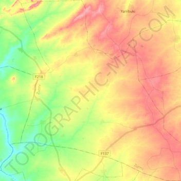
Name: Kanwa topographic map, elevation, terrain.
Location: Kanwa, Zurmi, Zamfara State, Nigeria (12.64240 6.55002 12.81092 6.71797)
Average elevation: 412 m
Minimum elevation: 357 m
Maximum elevation: 462 m
Other topographic maps
Click on a map to view its topography, its elevation and its terrain.