
Sikles topographic map
Interactive map
Click on the map to display elevation.
About this map
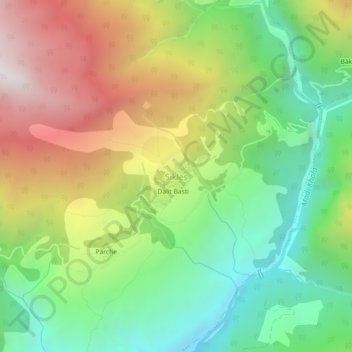
Name: Sikles topographic map, elevation, terrain.
Location: Sikles, Madi, Kaski, Gandaki Province, Nepal (28.33796 84.08499 28.37796 84.12499)
Average elevation: 1,892 m
Minimum elevation: 1,181 m
Maximum elevation: 2,899 m
Other topographic maps
Click on a map to view its topography, its elevation and its terrain.
Phewa Lake
Nepal > Gandaki Province > Kaski > Pokhara
Phewa Lake, Phewa Tal or Fewa Lake (Nepali: फेवा ताल, [ˈpʰewa tal]) is a freshwater lake in Nepal formerly called Baidam Tal located in the south of the Pokhara Valley that includes Pokhara city and parts of Sarangkot and Kaskikot. It is the second largest lake in Nepal and the largest in…
Average elevation: 884 m