Geolocate

El Fifi topographic map

Click on the map to display elevation.

About this map

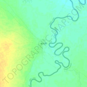
Name: El Fifi topographic map, elevation, terrain.

Location: El Fifi, South Darfur, Sudan (9.99738 24.98415 10.07738 25.06415)

Average elevation: 487 m

Minimum elevation: 478 m

Maximum elevation: 502 m

Other topographic maps

Click on a map to view its topography, its elevation and its terrain.

Buram

Sudan > South Darfur

Average elevation: 594 m

Gear up for your next adventure:

👖Packable Overtrousers - Quick-deploy rain protection for legs in sudden storms
🗺️Ordnance Survey Maps - Official UK maps for walking and outdoor activities
🎿Telescopic Trekking Poles - Reduces knee strain on steep topographic descents
🥤Hydration Bladders - Hands-free hydration systems for backpacks
🚲Cycling GPS Computers - Track elevation and topographic routes on two wheels

As an Amazon Associate, this site earns from qualifying purchases at no extra cost to you.