
Lukunga topographic map
Interactive map
Click on the map to display elevation.
About this map
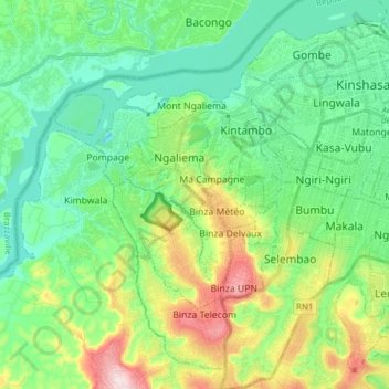
Name: Lukunga topographic map, elevation, terrain.
Location: Lukunga, Democratic Republic of the Congo (-4.43409 15.19057 -4.29647 15.34562)
Average elevation: 328 m
Minimum elevation: 226 m
Maximum elevation: 592 m
Other topographic maps
Click on a map to view its topography, its elevation and its terrain.