Geolocate

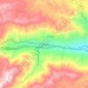
Bellavista topographic map

Click on the map to display elevation.

About this map

Name: Bellavista topographic map, elevation, terrain.

Location: Bellavista, Cisneros, Nordeste, Antioquia, RAP del Agua y la Montaña, Colombia (6.54467 -75.13674 6.56966 -75.10428)

Average elevation: 1,620 m

Minimum elevation: 1,162 m

Maximum elevation: 1,838 m

Other topographic maps

Click on a map to view its topography, its elevation and its terrain.
Cisneros

Colombia > Antioquia > Cisneros

Cisneros is a town and municipality in the Antioquia Department, Colombia. Part of the subregion of Northeastern Antioquia, it lies at an altitude of 1,050 m (3,440 ft) above sea level.

Average elevation: 1,440 m

Gear up for your next adventure:

🎒Hiking Child Carriers - Explore the outdoors with the whole family safely
🧴Sport Sunscreen Sticks - High-protection sunblock that won't run into your eyes on the trail
🔦Outdoor Torches - Reliable torches for night navigation
📸Action Camera Chest Mounts - Record your ascent following topographic paths hands-free
🧥Packable Down Jackets - Lightweight warmth that compresses small in your bag

As an Amazon Associate, this site earns from qualifying purchases at no extra cost to you.