Geolocate

Broughton topographic map

Click on the map to display elevation.
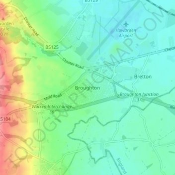
About this map

Name: Broughton topographic map, elevation, terrain.

Location: Broughton, Flintshire, Wales, CH4 0QN, United Kingdom (53.14502 -3.00752 53.18502 -2.96752)

Average elevation: 25 m

Minimum elevation: 0 m

Maximum elevation: 88 m

Flintshire trails, hiking, mountain biking, running and outdoor activities

Other topographic maps

Click on a map to view its topography, its elevation and its terrain.

Ewloe Castle

United Kingdom > Wales > Flintshire > Ewloe

Average elevation: 74 m

Penyffordd

United Kingdom > Wales > Flintshire

Average elevation: 101 m

Bagilt Reservior

United Kingdom > Wales > Flintshire > Bagillt

Average elevation: 32 m

Wepre Park

United Kingdom > Wales > Flintshire > Connah's Quay

Average elevation: 46 m

Saltney

United Kingdom > Wales > Flintshire

Average elevation: 9 m

Point of Ayr

United Kingdom > Wales > Flintshire > Talacre

Average elevation: 2 m

Nannerch

United Kingdom > Wales > Flintshire > Nannerch

Average elevation: 232 m

Gear up for your next adventure:

🧢Thermal Beanie Hats - Prevent heat loss from the head in windy summit conditions
🔋Solar Power Banks - Keep your GPS and phone charged during multi-day expeditions
🖼️Topographic Map Art - Decorative 3D-effect posters of famous UK peaks and regions
🔋Rechargeable Batteries - Eco-friendly power for headlamps and older GPS units
Lightweight Tents - Compact tents for backpacking and trekking

As an Amazon Associate, this site earns from qualifying purchases at no extra cost to you.