
Hebron topographic map
Click on the map to display elevation.
About this map
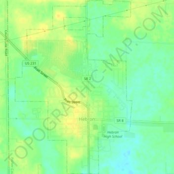
Name: Hebron topographic map, elevation, terrain.
Location: Hebron, Porter County, Indiana, United States (41.30847 -87.21804 41.34064 -87.18919)
Average elevation: 213 m
Minimum elevation: 201 m
Maximum elevation: 223 m
Other topographic maps
Click on a map to view its topography, its elevation and its terrain.
Indiana Dunes State Park
United States > Indiana > Porter County > Chesterton
Average elevation: 186 m
Beverly Shores
United States > Indiana > Porter County > Beverly Shores > Beverly Shores
Average elevation: 182 m