
Locust Grove topographic map
Interactive map
Click on the map to display elevation.
About this map
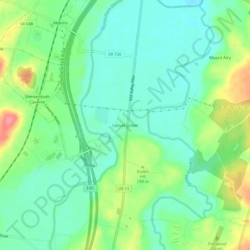
Name: Locust Grove topographic map, elevation, terrain.
Average elevation: 281 m
Minimum elevation: 255 m
Maximum elevation: 335 m
Other topographic maps
Click on a map to view its topography, its elevation and its terrain.
Strasburg
United States > Virginia > Shenandoah County
According to the United States Census Bureau, the town has a total area of 3.2 square miles (8.2 km2), of which, 3.2 square miles (8.2 km2) of it is land and 0.04 square miles (0.1 km2) of it (0.63%) is water. The elevation of the area is 578 ft (176 m).
Average elevation: 195 m