
Videseter topographic map
Click on the map to display elevation.
About this map
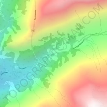
Name: Videseter topographic map, elevation, terrain.
Location: Videseter, Stryn, Vestland, Norway (61.93004 7.26116 61.95004 7.28116)
Average elevation: 899 m
Minimum elevation: 227 m
Maximum elevation: 1,740 m
Other topographic maps
Click on a map to view its topography, its elevation and its terrain.