
Pfaffschwende topographic map
Interactive map
Click on the map to display elevation.
About this map
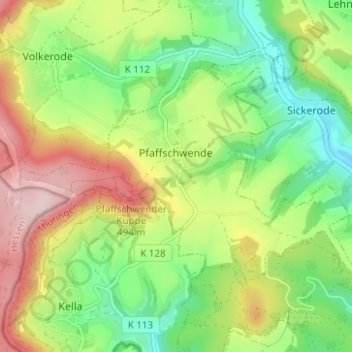
Name: Pfaffschwende topographic map, elevation, terrain.
Average elevation: 351 m
Minimum elevation: 227 m
Maximum elevation: 530 m
Other topographic maps
Click on a map to view its topography, its elevation and its terrain.
Haynrode
Germany > Thuringia > Landkreis Eichsfeld
Haynrode, Eichsfeld-Wipperaue, Landkreis Eichsfeld, Thuringia, Germany
Average elevation: 381 m
Sonnenstein
Germany > Thuringia > Landkreis Eichsfeld
Sonnenstein, Landkreis Eichsfeld, Thuringia, Germany
Average elevation: 295 m