
Sonnenstein topographic map
Interactive map
Click on the map to display elevation.
About this map
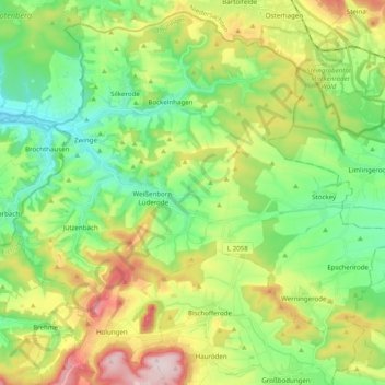
Name: Sonnenstein topographic map, elevation, terrain.
Location: Sonnenstein, Landkreis Eichsfeld, Thuringia, Germany (51.47781 10.34308 51.59270 10.53953)
Average elevation: 295 m
Minimum elevation: 168 m
Maximum elevation: 530 m
Other topographic maps
Click on a map to view its topography, its elevation and its terrain.
Haynrode
Germany > Thuringia > Landkreis Eichsfeld
Haynrode, Eichsfeld-Wipperaue, Landkreis Eichsfeld, Thuringia, Germany
Average elevation: 381 m
Pfaffschwende
Germany > Thuringia > Landkreis Eichsfeld
Pfaffschwende, Ershausen/Geismar, Landkreis Eichsfeld, Thuringia, Germany
Average elevation: 351 m