
Ngata topographic map
Interactive map
Click on the map to display elevation.
About this map
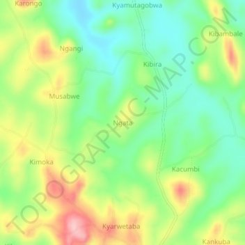
Name: Ngata topographic map, elevation, terrain.
Location: Ngata, Kyegegwa, Western Region, Uganda (0.50101 31.02375 0.54101 31.06375)
Average elevation: 1,346 m
Minimum elevation: 1,279 m
Maximum elevation: 1,447 m
Other topographic maps
Click on a map to view its topography, its elevation and its terrain.