
Khentii topographic map
Interactive map
Click on the map to display elevation.
About this map
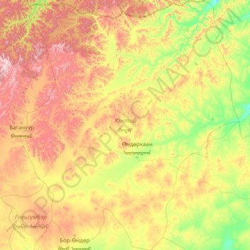
Name: Khentii topographic map, elevation, terrain.
Location: Khentii, Mongolia (46.05985 108.38564 49.39189 112.69405)
Average elevation: 1,276 m
Minimum elevation: 850 m
Maximum elevation: 2,646 m
Other topographic maps
Click on a map to view its topography, its elevation and its terrain.
Khangal Lake
Mongolia > Khentii > Ömnödelger
Khangal Lake, Ömnödelger, Khentii, Mongolia
Average elevation: 1,350 m