
Gaza topographic map
Click on the map to display elevation.
Gaza
Central Gaza is situated on a low-lying and round hill with an elevation of 14 metres (46 ft) above sea level. Much of the modern city is built along the plain below the hill, especially to the north and east, forming Gaza's suburbs. The beach and the port of Gaza are located 3 kilometres (1.9 mi) west of the city's nucleus and the space in between is entirely built up on low-lying hills.
About this map
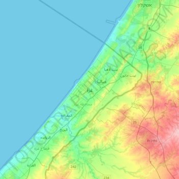
Name: Gaza topographic map, elevation, terrain.
Average elevation: 41 m
Minimum elevation: 0 m
Maximum elevation: 186 m
Other topographic maps
Click on a map to view its topography, its elevation and its terrain.
Wadi al Qilt
Palestinian Territories > Judea and Samaria > Area C > Ma'ale Adumim > Wadi al Qilt
Average elevation: 96 m