
Kula topographic map
Interactive map
Click on the map to display elevation.
About this map
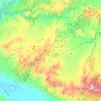
Name: Kula topographic map, elevation, terrain.
Location: Kula, Manisa, Aegean Region, Turkey (38.38157 28.41993 38.73967 28.85711)
Average elevation: 591 m
Minimum elevation: 120 m
Maximum elevation: 1,545 m
Other topographic maps
Click on a map to view its topography, its elevation and its terrain.
Battalmustafa
Turkey > Kula > Battalmustafa
Battalmustafa, Kula, Manisa, Aegean Region, Turkey
Average elevation: 667 m