Geolocate

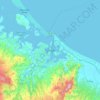
Bayfair topographic map

Click on the map to display elevation.

About this map

Name: Bayfair topographic map, elevation, terrain.

Location: Bayfair, Tauranga City, Bay of Plenty, New Zealand (-37.70814 176.17399 -37.66471 176.24591)

Average elevation: 8 m

Minimum elevation: -1 m

Maximum elevation: 111 m

Other topographic maps

Click on a map to view its topography, its elevation and its terrain.
Tauranga

New Zealand > Bay of Plenty > Tauranga City

Average elevation: 66 m

Mangatawa

New Zealand > Bay of Plenty > Tauranga City > Papamoa

Average elevation: 18 m

Tauranga

New Zealand > Bay of Plenty > Tauranga City

Average elevation: 63 m

Greerton

New Zealand > Bay of Plenty > Tauranga City

Average elevation: 31 m

Tauranga

New Zealand > Bay of Plenty > Tauranga City

Average elevation: 66 m

Tauranga

New Zealand > Bay of Plenty > Tauranga City

Average elevation: 66 m

Tauranga

New Zealand > Bay of Plenty > Tauranga City

Average elevation: 66 m

Tauranga

New Zealand > Bay of Plenty > Tauranga City

Average elevation: 66 m

Gear up for your next adventure:

🔦LED Camping Lanterns - Illumination for reading maps inside your tent at night
👟Waterproof Leg Gaiters - Keep mud and water out of your boots in boggy terrain
🧭GPS Trackers - Tracking devices for safety and navigation
🧢Hiking Hats - Sun and weather protection for outdoor walks
🧼Technical Clothing Wash - Special soap to clean and restore waterproof membranes

As an Amazon Associate, this site earns from qualifying purchases at no extra cost to you.