
Seikphyu Township topographic map
Interactive map
Click on the map to display elevation.
About this map
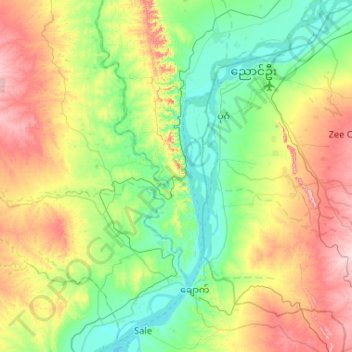
Name: Seikphyu Township topographic map, elevation, terrain.
Location: Seikphyu Township, Pakokku District, Magway, Myanmar (20.83708 94.29442 21.26677 94.81405)
Average elevation: 166 m
Minimum elevation: 40 m
Maximum elevation: 437 m
Other topographic maps
Click on a map to view its topography, its elevation and its terrain.