
Manan-gu topographic map
Interactive map
Click on the map to display elevation.
About this map
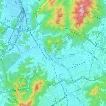
Name: Manan-gu topographic map, elevation, terrain.
Location: Manan-gu, Anyang-si, Gyeonggi, South Korea (37.35680 126.87001 37.45020 126.94893)
Average elevation: 121 m
Minimum elevation: 9 m
Maximum elevation: 612 m
Other topographic maps
Click on a map to view its topography, its elevation and its terrain.