
Dongan-gu topographic map
Interactive map
Click on the map to display elevation.
About this map
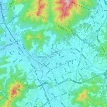
Name: Dongan-gu topographic map, elevation, terrain.
Location: Dongan-gu, Anyang-si, Gyeonggi, South Korea (37.36160 126.92733 37.44100 126.98297)
Average elevation: 115 m
Minimum elevation: 16 m
Maximum elevation: 602 m
Other topographic maps
Click on a map to view its topography, its elevation and its terrain.