
Make a donation
Gear up for your next adventure:
As an Amazon Associate, this site earns from qualifying purchases at no extra cost to you.
Mutso topographic map
Click on the map to display elevation.
Make a donation
Gear up for your next adventure:
As an Amazon Associate, this site earns from qualifying purchases at no extra cost to you.
About this map
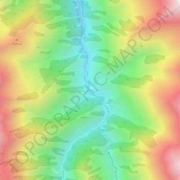
Name: Mutso topographic map, elevation, terrain.
Location: Mutso, Dusheti Municipality, Mtskheta-Mtianeti, Georgia (42.58567 45.18631 42.62567 45.22631)
Average elevation: 2,109 m
Minimum elevation: 1,483 m
Maximum elevation: 2,947 m
Make a donation
Gear up for your next adventure:
As an Amazon Associate, this site earns from qualifying purchases at no extra cost to you.
Other topographic maps
Click on a map to view its topography, its elevation and its terrain.
Pasanauri
Georgia > Mtskheta-Mtianeti > Dusheti Municipality
Pasanauri lies about 90 kilometres (56 mi) north of the nation's capital of Tbilisi, at elevation of 1,050 m. above sea level. Located on the Georgian Military Road, Pasanauri is flanked by the Aragvi River, and surrounded by the Caucasus Mountains. Average winter temperature is 0 degrees Celsius, but often…
Average elevation: 1,507 m
Make a donation
Gear up for your next adventure:
As an Amazon Associate, this site earns from qualifying purchases at no extra cost to you.