
Samagaon topographic map
Interactive map
Click on the map to display elevation.
About this map
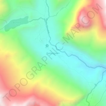
Name: Samagaon topographic map, elevation, terrain.
Location: Samagaon, Chum Nubri, Gorkha, Gandaki Province, Nepal (28.56467 84.62404 28.60467 84.66404)
Average elevation: 3,918 m
Minimum elevation: 3,397 m
Maximum elevation: 4,774 m
Other topographic maps
Click on a map to view its topography, its elevation and its terrain.