
Idanre topographic map
Interactive map
Click on the map to display elevation.
About this map
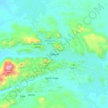
Name: Idanre topographic map, elevation, terrain.
Location: Idanre, Ondo State, Nigeria (7.06977 5.07644 7.14977 5.15644)
Average elevation: 375 m
Minimum elevation: 240 m
Maximum elevation: 957 m
Other topographic maps
Click on a map to view its topography, its elevation and its terrain.