Geolocate

Mengla topographic map

Click on the map to display elevation.

About this map
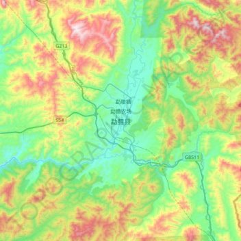
Name: Mengla topographic map, elevation, terrain.

Location: Mengla, Mengla County, Xishuangbanna, Yunnan, 666300, China (21.30185 101.40503 21.62185 101.72503)

Average elevation: 932 m

Minimum elevation: 581 m

Maximum elevation: 1,624 m

Other topographic maps

Click on a map to view its topography, its elevation and its terrain.

Mohan

China > Yunnan > Mengla County

Average elevation: 962 m

Gear up for your next adventure:

⌚GPS Outdoor Watches - Watches with GPS tracking for hiking and exploration
🥾Hiking Boots - Waterproof and durable boots for long-distance hiking in the UK
🔋Lithium AA Batteries - Long-lasting power that performs well in cold mountain weather
👕Merino Base Layers - Natural temperature regulation for cold weather hiking and camping
🧢Thermal Beanie Hats - Prevent heat loss from the head in windy summit conditions

As an Amazon Associate, this site earns from qualifying purchases at no extra cost to you.