Geolocate

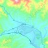
Mohan topographic map

Click on the map to display elevation.

About this map

Name: Mohan topographic map, elevation, terrain.

Location: Mohan, Mengla County, Xishuangbanna, Yunnan, 666100, China (21.14314 101.39843 21.48218 101.84467)

Average elevation: 962 m

Minimum elevation: 616 m

Maximum elevation: 1,641 m

Other topographic maps

Click on a map to view its topography, its elevation and its terrain.
Mengla

China > Yunnan > Mengla County

Average elevation: 932 m

Menglun

China > Yunnan > Mengla County

Average elevation: 669 m

Gear up for your next adventure:

🎒Hiking Child Carriers - Explore the outdoors with the whole family safely
🥾Walking Shoes - Lightweight walking shoes for countryside and coastal paths
🔪Outdoor Multi-Tools - Versatile tools for gear repairs and food prep in the wild
🥄Titanium Camping Sporks - The ultimate lightweight utensil for trail meals
🥾Women's Waterproof Hiking Boots - High-performance trekking boots designed for all-weather comfort

As an Amazon Associate, this site earns from qualifying purchases at no extra cost to you.