Geolocate

Cutler topographic map

Click on the map to display elevation.

About this map
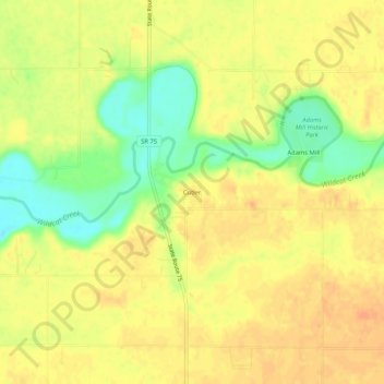
Name: Cutler topographic map, elevation, terrain.

Location: Cutler, Carroll County, Indiana, 46920, United States (40.45642 -86.54416 40.49642 -86.50416)

Average elevation: 223 m

Minimum elevation: 199 m

Maximum elevation: 235 m

Other topographic maps

Click on a map to view its topography, its elevation and its terrain.

Delphi

United States > Indiana > Carroll County

Average elevation: 179 m

Delphi

United States > Indiana > Carroll County

Average elevation: 179 m

Gear up for your next adventure:

🧼Biodegradable Soap - Leave-no-trace hygiene for multi-day mountain treks
🚲Bikepacking Frame Bags - Storage for tools and navigation gear on long off-road rides
📚UK Hiking Guidebooks - Detailed route descriptions for the Lake District, Peaks, and Highlands
⛺Camping Shelters - Emergency and lightweight shelters for outdoor use
🧢Waterproof Hiking Hats - Keep the rain off your face while studying topographic maps

As an Amazon Associate, this site earns from qualifying purchases at no extra cost to you.