Geolocate

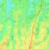
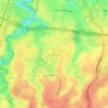
Curug topographic map

Click on the map to display elevation.

About this map

Name: Curug topographic map, elevation, terrain.

Location: Curug, Bojongsari, Depok, Bogor, West Java, Java, Indonesia (-6.41628 106.72164 -6.37770 106.74239)

Average elevation: 85 m

Minimum elevation: 57 m

Maximum elevation: 101 m

Other topographic maps

Click on a map to view its topography, its elevation and its terrain.
Kalibaru

Indonesia > West Java > Bogor > Depok

Average elevation: 102 m

Alun-alun Sukamaju

Indonesia > West Java > Bogor > Depok > Sukamaju

Average elevation: 100 m

Cimpaeun

Indonesia > West Java > Bogor > Depok

Average elevation: 109 m

Situ Sidomukti

Indonesia > West Java > Bogor > Depok > Sukamaju

Average elevation: 97 m

Jatijajar

Indonesia > West Java > Bogor > Depok

Average elevation: 95 m

Bakti Jaya

Indonesia > West Java > Bogor > Depok

Average elevation: 82 m

Krukut

Indonesia > West Java > Bogor > Depok > Krukut

Average elevation: 64 m

Harjamukti

Indonesia > West Java > Bogor > Depok

Average elevation: 77 m

Gear up for your next adventure:

🧊Personal Water Filters - Drink safely from mountain streams marked on your map
🥤Collapsible Water Bottles - Save space in your rucksack as you consume your water
🔦Keychain LED Torches - Emergency backup light for finding gear in your pack
☕Insulated Travel Mugs - Keep drinks hot while surveying the landscape from a summit
🧴Sport Sunscreen Sticks - High-protection sunblock that won't run into your eyes on the trail

As an Amazon Associate, this site earns from qualifying purchases at no extra cost to you.