
Lydham topographic map
Click on the map to display elevation.
About this map
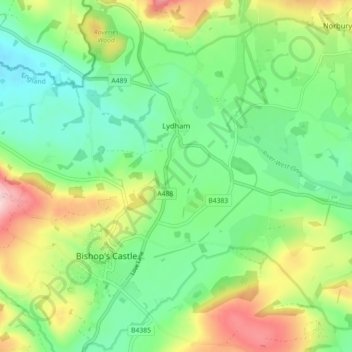
Name: Lydham topographic map, elevation, terrain.
Location: Lydham, Shropshire, England, United Kingdom (52.47997 -3.03671 52.53198 -2.94722)
Average elevation: 202 m
Minimum elevation: 129 m
Maximum elevation: 338 m
Shropshire trails, hiking, mountain biking, running and outdoor activities
Other topographic maps
Click on a map to view its topography, its elevation and its terrain.
Minton
United Kingdom > England > Shropshire > Church Stretton > Little Stretton
Average elevation: 272 m