Geolocate

Center Township topographic map

Interactive map

Click on the map to display elevation.

About this map

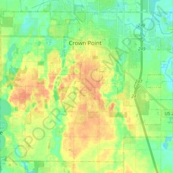
Name: Center Township topographic map, elevation, terrain.

Location: Center Township, Lake County, Indiana, 46307, United States (41.34745 -87.43123 41.43530 -87.29672)

Average elevation: 220 m

Minimum elevation: 204 m

Maximum elevation: 240 m

Other topographic maps

Click on a map to view its topography, its elevation and its terrain.

Triangle Parkway

United States > Indiana > Lake County > Hammond

Average elevation: 184 m

Liverpool

United States > Indiana > Lake County > Lake Station

Average elevation: 191 m

Illinoi

United States > Indiana > Lake County

Average elevation: 192 m

Lake Seven

United States > Indiana > Lake County > Crown Point

Average elevation: 220 m

Glen Park

United States > Indiana > Lake County > Gary

Average elevation: 193 m

Miller

United States > Indiana > Lake County > Gary > Miller

Average elevation: 186 m