Geolocate

Sunnyvale topographic map

Click on the map to display elevation.

About this map

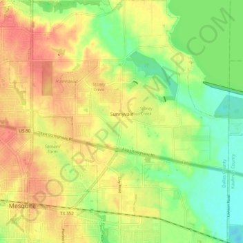
Name: Sunnyvale topographic map, elevation, terrain.

Location: Sunnyvale, Dallas County, Texas, 75182, United States (32.75434 -96.60443 32.83369 -96.51926)

Average elevation: 142 m

Minimum elevation: 112 m

Maximum elevation: 168 m

Other topographic maps

Click on a map to view its topography, its elevation and its terrain.

Tripp

United States > Texas > Dallas County > Sunnyvale

Average elevation: 143 m

Gear up for your next adventure:

🧴Sport Sunscreen Sticks - High-protection sunblock that won't run into your eyes on the trail
💧Hydration Reservoirs - Convenient water bladders for hands-free drinking on the move
📻Hand-Crank Emergency Radios - Stay updated on weather warnings in remote areas
🧰First Aid Kits - Essential safety kits for outdoor activities
👕Technical Hiking Tees - Moisture-management for high-exertion climbs

As an Amazon Associate, this site earns from qualifying purchases at no extra cost to you.