Geolocate

Mt. Myoko topographic map

Click on the map to display elevation.

About this map

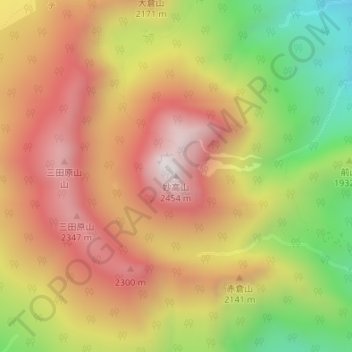
Name: Mt. Myoko topographic map, elevation, terrain.

Location: Mt. Myoko, Myoko, Niigata Prefecture, Chubu Region, Japan (36.89125 138.11343 36.89135 138.11353)

Average elevation: 2,005 m

Minimum elevation: 1,452 m

Maximum elevation: 2,442 m

Gear up for your next adventure:

🛌Insulated Sleeping Mats - Crucial thermal protection when sleeping on cold, uneven ground
📕Outdoor Navigation Books - Learn traditional and modern navigation techniques
🌦️Portable Weather Meters - Handheld tools for monitoring weather conditions
🧭GPS Trackers - Tracking devices for safety and navigation
🛰️Handheld GPS Devices - Reliable GPS units for hiking and outdoor navigation

As an Amazon Associate, this site earns from qualifying purchases at no extra cost to you.