
Rhotia topographic map
Interactive map
Click on the map to display elevation.
About this map
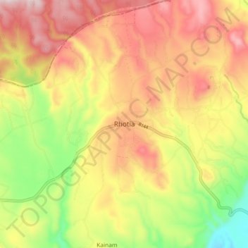
Name: Rhotia topographic map, elevation, terrain.
Location: Rhotia, Karatu, Arusha, Northern Zone, Tanzania (-3.35267 35.69341 -3.27267 35.77341)
Average elevation: 1,557 m
Minimum elevation: 1,292 m
Maximum elevation: 1,786 m
Other topographic maps
Click on a map to view its topography, its elevation and its terrain.
Makao Mapya
Tanzania > Arusha > Makao Mapya
Makao Mapya, Arumeru, Arusha, Northern Zone, Tanzania
Average elevation: 911 m