
Ilemela Municipal topographic map
Interactive map
Click on the map to display elevation.
About this map
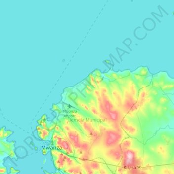
Name: Ilemela Municipal topographic map, elevation, terrain.
Location: Ilemela Municipal, Mwanza, Lake Zone, Tanzania (-2.56690 32.87436 -2.25825 33.15956)
Average elevation: 1,165 m
Minimum elevation: 1,130 m
Maximum elevation: 1,346 m
Other topographic maps
Click on a map to view its topography, its elevation and its terrain.