
La Ruà topographic map
Interactive map
Click on the map to display elevation.
About this map
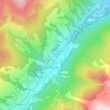
Name: La Ruà topographic map, elevation, terrain.
Location: La Ruà, Pragela, Turin, Piémont, Italie (44.99577 6.92125 45.03577 6.96125)
Average elevation: 1,870 m
Minimum elevation: 1,438 m
Maximum elevation: 2,585 m
Other topographic maps
Click on a map to view its topography, its elevation and its terrain.
Pattemouche
Italie > Piémont > Turin > Pragela
Pattemouche, Pragela, Turin, Piémont, 10058, Italie
Average elevation: 1,912 m
Soucheres Hautes
Italie > Piémont > Turin > Pragela
Soucheres Hautes, Pragela, Turin, Piémont, Italie
Average elevation: 1,874 m