
Vesturland topographic map
Interactive map
Click on the map to display elevation.
About this map
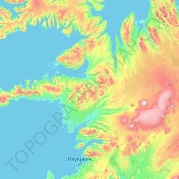
Name: Vesturland topographic map, elevation, terrain.
Location: Vesturland, Ísland (64.29806 -24.04829 65.49382 -19.87615)
Average elevation: 180 m
Minimum elevation: -5 m
Maximum elevation: 1,677 m
Other topographic maps
Click on a map to view its topography, its elevation and its terrain.