Geolocate

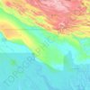
Kapuna topographic map

Click on the map to display elevation.

About this map

Name: Kapuna topographic map, elevation, terrain.

Location: Kapuna, Kikori District, Gulf, Southern Region, Papua New Guinea (-7.59650 144.94432 -7.55650 144.98432)

Average elevation: 5 m

Minimum elevation: -2 m

Maximum elevation: 17 m

Other topographic maps

Click on a map to view its topography, its elevation and its terrain.

Purari River

Papua New Guinea > Gulf

Average elevation: 308 m

Kikori District

Papua New Guinea > Gulf

Average elevation: 441 m

Kikori River

Papua New Guinea > Gulf

Average elevation: 486 m

Gear up for your next adventure:

🍱Food Containers - Reusable containers for outdoor meals
🎒Backpack Rain Covers - Universal waterproof covers to protect your gear from downpours
📻Hand-Crank Emergency Radios - Stay updated on weather warnings in remote areas
🗺️Ordnance Survey Maps - Essential paper maps for hiking across the UK national parks
🐕Hiking Dog Harnesses - Rugged harnesses for taking your companion on mountain trails

As an Amazon Associate, this site earns from qualifying purchases at no extra cost to you.